Greenock in 1877
In the 1870s the Burgh of Greenock decided to embark on an improvement program covering the central area of the town. This had grown up haphazardly since the eighteenth century and was a warren of narrow streets, dank closes and poor housing.
One of the prime motivations behind the scheme was the eradication of disease, especially cholera, which had afflicted the town throughout the nineteenth century. The improvement scheme involved the demolition of the old buildings and the creation of a new street pattern. Only odd vestiges of the old area remain, such as Drummer's Close, a reminder of the old Greenock seen in the photographs here.
Prior to starting work the Burgh conducted a photographic survey of the area to be redeveloped, providing an invaluable record of the way the town was before the large scale changes of the later nineteenth century.
The text and images on this page are the copyright of the McLean Museum and Art Gallery. For enquiries about this collection please contact us at wattinstitution@inverclyde.gov.uk.
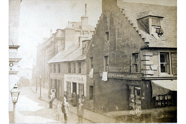
Taylor's Close, Greenock
This view shows the corner of Taylor's Close and Hamilton Street, Greenock around 1877. Photographer unknown - Bromide print on paper - P4190 - © McLean Museum and Art Gallery, Greenock
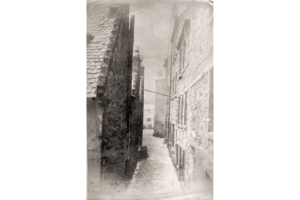
Drummer's Close, Greenock
This image shows a view of Drummer's Close from Dalrymple Street, Greenock. Drummer's Close was one of the few old streets to survive the 1877 improvement. - Photographer unknown - Bromide print on paper - P4072 - © McLean Museum and Art Gallery, Greenock
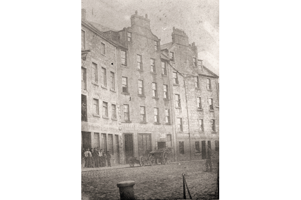
Fairgrieve's Property, West Breast, Greenock 1879
Fairgieve's Property on the West Breast near the harbour is a now completely vanished scene, disappearing during the 1877 improvement scheme. - Bromide print on paper - 2003.31 - © McLean Museum and Art Gallery, Greenock
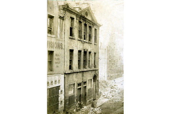
The Anchor Inn, Shaw Stree, Greenock
This view of the Anchor Inn shows the building from the south side. In the background right is the old Shaw Street School. - Bromide print on paper - P4202 - © McLean Museum and Art Gallery, Greenock
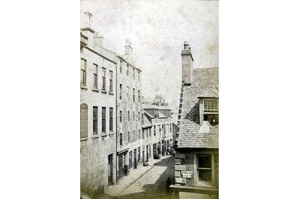
Taylor's Close and Hamilton Street, Greenock
This view shows Taylor's Close leading down from Hamilton Street, Greenock, showing the Phoenix Works. - Bromide print on paper - P4204 - © McLean Museum and Art Gallery, Greenock
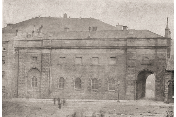
Police Office building, Wallace Place, Greenock
This view shows the new Police Buildings in Wallace Place and the carriage entrance to the Town Hall. - Bromide print on paper - P4206 - © McLean Museum and Art Gallery, Greenock
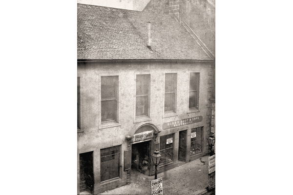
The Old Town Hall, Greenock
This view shows the façade of the Old Town Hall at 6 Hamilton Street, Greenock, probably taken around 1877. - Bromide print on paper - P4207 - © McLean Museum and Art Gallery, Greenock
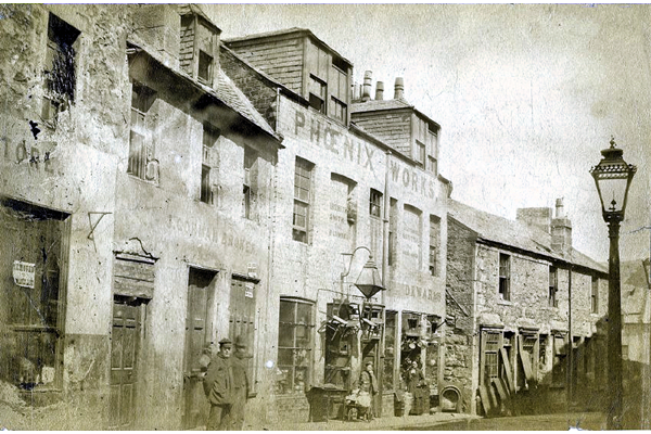
Taylor's Close, Greenock - east side
This view shows the east side of Taylor's Close with the Phoenix Works. It was probably taken around 1877 - Bromide print on paper - P4209 - © McLean Museum and Art Gallery, Greenock
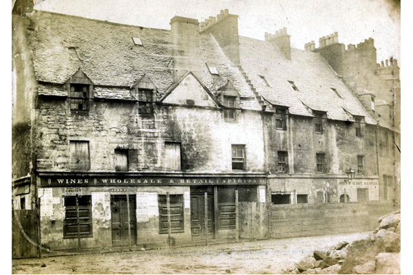
Vennel and Dalrymple Street, Greenock
This view shows shops and houses in bad repair at the corner of Vennel and Dalrymple Street on the north side of Wallace Square, Greenock. - Photographed by Robert Urie - Bromide print on paper - P4211 - © McLean Museum and Art Gallery, Greenock
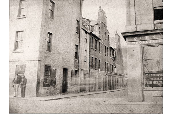
Vennel, Greenock
This view shows the Vennel area of Greenock opposite the Old West Graving Dock at foot of Vennel. - Bromide print on paper - P4212 - © McLean Museum and Art Gallery, Greenock
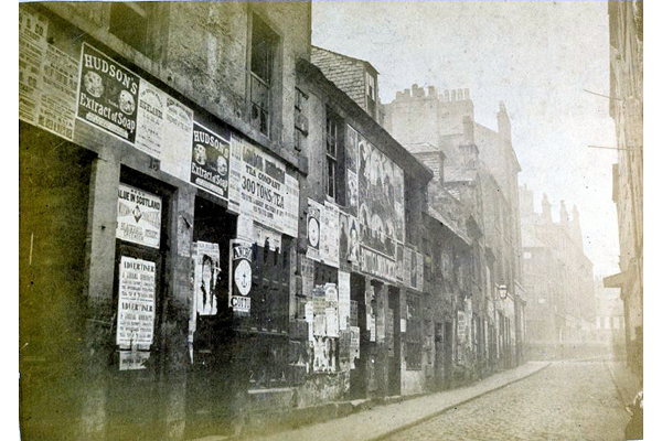
Low Vennel, opposite Hunter's Place, Greenock
This view shows the east side of Low Vennel opposite Hunter Place, Greenock showing a street of dilapidated houses covered with advertising posters. - P4214 © McLean Museum and Art Gallery, Greenock
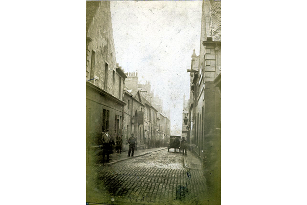
East Quay Lane, Greenock
East Quay Lane, Greenock had an unsavoury reputation for crime. It was the main route for passengers between Greenock Central Station and Steamboat Quay (Custom House Quay). The street was located roughly where the current Brymner Street is. - Bromide print on paper - P4215 - © McLean Museum and Art Gallery, Greenock
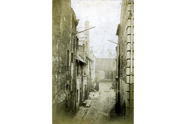
Longwell Close from Dalrymple Street, Greenock
The well in Longwell Close was one of the water sources for this area of Greenock. Longwell Close was located roughly where the modern Duff Street is. - Bromide print on paper - P4217 - © McLean Museum and Art Gallery, Greenock
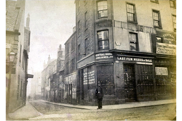
The junction of Low Vennel and Hamilton Street, Greenock
This view of the area was taken just prior to demolition. As one of the notices on the buildings states: 'The Town Improvement Bill - These premises coming down'. - Bromide print on paper - P4218 - © McLean Museum and Art Gallery, Greenock


